Science-Design Loop for Interdisciplinary Dialogue and Collaborative Thinking
Our module aims to design landscapes for resilient and sustainable cities harnessing the potential of blue-green infrastructures. We explore this option in the capital city of Madagascar, Antananarivo. We follow a science-design loop approach, meaning that designers and scientists from different disciplines are in constant dialogue to create informed proposals. This dialogue is constantly under the influence and review by our partners and stakeholders with whom we work as closely as possible.
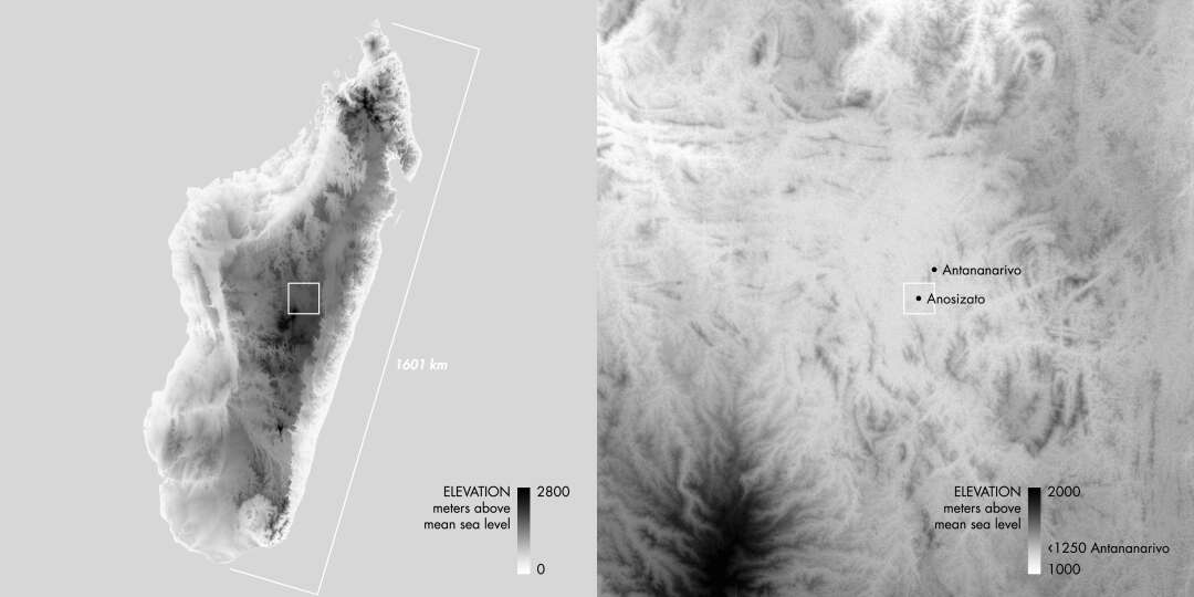
We use point-cloud models for the precise documentation of critical infrastructures like the complex irrigation and drainage systems of Antananarivo. We use these models to explore topographic modifications together with hydrological models that can assess their effect on floods.
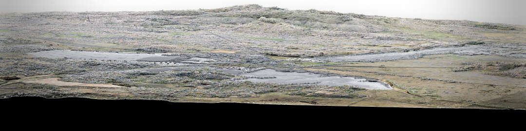
We create new designs (shown here in grey) on the ground of scientific insights provided by our team about the socio-economical and ecological context of the city. Finally, we share inspiring visualizations from modified point-cloud models with our partners and stakeholders. At the end, our designs value the multifunctional peri-agro-urban landscapes of Antananarivo where rice fields, raised gardens and fishing grounds maintain a significant food supply to the city and ensure a livelihood for many while buffering flood risks by storing water during the rainy season. These designs catalyse local solutions already constructed by inhabitants themselves. Our ambition has been to support these adaptive endemic landscapes by making them more visible and valuable for decision-makers.
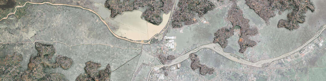
Pluvial floods fill the polder during the monsoon season, as can be seen on this orthophoto. Simulation of overland flow on point cloud models indicates how polders can be flooded during the rainy season or irrigated during the dry season (as shown here in black overlay). Simulation is integrated into the design process to produce functional scenarios.
Food and Territories / [RES] Resilient Blue-Green Infrastructures
Principal Investigators: Prof. Dr. Adrienne Grêt-Regamey, Prof. Dr. Michiel van Breugel
Co- Investigators: Dr. Perrine Burnod, Prof. em Christophe Girot, Dr. Joao Paul Leitao, Prof. Dr. Max Maurer, Prof. Dr. Peter Messerli, Prof. Dr. Bruno Ramamonjisoa, Prof. Dr. Julie Zähringer
Researchers: Nary Andriamananjatovo, Valérie Andriamanga, Dr. Ntsiva Andriatsitohaina, Constance Brouillet, Hoby Nambinintsoa Nomenjanahary, Luc Schmid, Fanny Voélin, Dr. Philipp Urech
Module Coordinator: Dr. Nicolas Salliou